Version History
Here you can find the changelog of Avia Maps Aeronautical Charts since it was posted on our website on 2016-10-07.
The latest version is 3.12.1 and it was updated on soft112.com on 01 April, 2024.
See below the changes in each version:
version 3.12.1
posted on 2024-03-13
Bugfix: Tiles without any aviation data (e.g. in the middle of the ocean) could not be removed from the device.
Minor bugfixes and performance improvements.
version 3.11.7
posted on 2024-01-14
Minor bugfixes and compatibility with Android 14.
version 3.11.6
posted on 2023-10-23
Bugfix: Airspaces were not drawn on Android 7 and older.
Minor bugfixes and compatibility with Android 14.
version 3.11.5
posted on 2023-10-23
Change: Updated French translation.
Bugfix and Performance: Changes in the map engine to reduce memory pressure and avoid OOM errors.
Minor bugfixes and compatibility with Android 14.
version 3.11.3
posted on 2023-10-04
NEW: Traffic overlay. The app can now receive and display GDL90 traffic data from Safe Sky and compatible ADS-B receivers.
Change: Updated Czech translation.
Bugfix: Handle aircraft models without mass variation between climb rate fulcrums.
Bugfix: Preparation for zoom level 14 base map update to keep file sizes below 4GB.
version 3.11.1
posted on 2023-07-06
NEW: Traffic overlay. The app can now receive and display GDL90 traffic data from Safe Sky and compatible ADS-B receivers.
version 3.10.8
posted on 2023-06-27
NEW: Colored terrain overlay depending on your current or manually selected altitude. After the download the app will first have to prepare the overlay once, which is a long running task. Available on Android 7+.
Change: The zoom buttons are now larger and moved from the toolbar to the bottom of the screen.
Change: Previously the .gpx route import was limited to 100 waypoints. Now tracks with more points can also be imported but are smoothed.
Several minor bugfixes.
version 3.9.2
posted on 2023-03-26
Bugfix: Fixed error which crashed the app when starting downloads in case the permission to show a download progress notification was never granted.
Minor bugfixes.
version N/A
posted on 2022-04-20
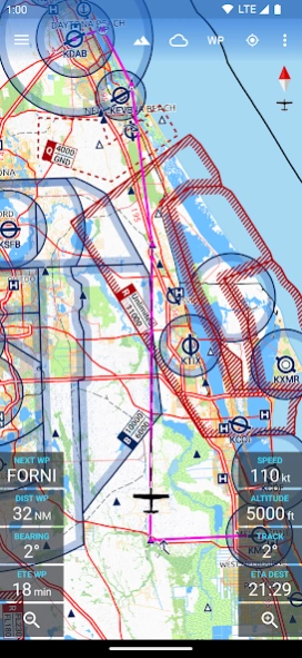
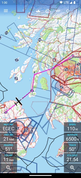
NEW: Navaid idents and names of smaller airports are now drawn on the map.
Bugfix: Fixed a bug which may have caused the app to crash when attempting to automatically resolve a sync conflict.
Bugfix: Crash caused by invalid characters in user waypoint names.
Minor bugfixes.
version N/A
posted on 2021-12-08
NEW: Synchronization for routes, aircraft models and user waypoints.
NEW: Import user waypoint names from GPX and FPL files.
NEW: Support for Android 12
Bugfix: Fixed a bug where waypoint names would not disappear when closing a route.
Bugfix: Incorrect GPX route import.
Completely reworked route storage to integrate sync and fixed several minor bugs in the process.
Improved map rendering performance.
version N/A
posted on 2021-12-08
NEW: Synchronization for routes, aircraft models and user waypoints
NEW: Additional icons for user waypoints (obstacle and warning)
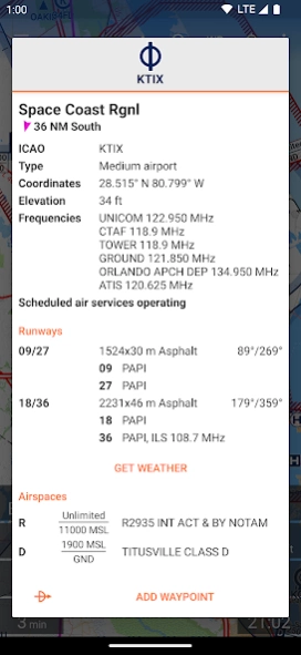
NEW: Button in the waypoint dialog to report data errors (outside the USA only, as US waypoint data is taken directly from the FAA)
Change: Increased touchable area for route waypoints on lower zoom levels.
version N/A
posted on 2021-11-22
Bugfix: Missing map overlay update when editing user waypoints which are not saved to database.
Fixed some bugs which could cause the app to crash in rare circumstances (less than 1% of users were affected).
version N/A
posted on 2021-09-27
NEW: Now drawing the names of user waypoints on the map (on higher zoom levels only).
NEW: Delete user waypoint via delete button in main waypoint dialog if it is not part of the current route (no need to first open the edit user waypoint dialog).
Change: User waypoints are now also visible on lower zoom levels.
Bugfix: Fixed missing "route has been changed" when moving a waypoint via drag-and-drop in the map.
Minor bugfixes.
version N/A
posted on 2021-07-21
Version 3.1:
NEW: User waypoints. Rename and save custom waypoints to permanently display them on the map and to use them in multiple routes.
Version 3.0:
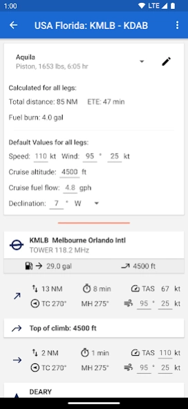
NEW: Aircraft Models to save multiple sets of default values for route planning. Including an option for unpowered aircraft.
NEW: Climb & Descent calculations. Depending on the performance of your A/C model, top of climb and top of descent will be calculated and drawn on the map.
version N/A
posted on 2021-06-27
NEW: Aircraft Models to save multiple sets of default values for route planning. Including an option for unpowered aircraft.
NEW: Climb & Descent calculations. Depending on the performance of your A/C model, top of climb and top of descent will be calculated and drawn on the map.
Change: Updated the display of legs in the "advanced route planning" screen to show more information.
Several minor bugfixes and some UI improvements.
version N/A
posted on 2021-06-18
NEW: Different icons for mandatory and optional VFR reporting points
Change: Now using vector drawables throughout the app to better support high DPI devices
Change: Fixed some typos in Spanish and Czech translations
Bugfix: Fixed potential crash when moving the first waypoint within the map
version 2.7.10
posted on 2021-04-17
Change: Improved Czech translation
Bugfix: Prevent duplicate waypoints when using in-map route editing
version 2.7.9f
posted on 2021-02-23
NEW: Instant display of search results when searching by keyword in waypoint search dialog.
NEW: Czech translation.
Change: Updated Spanish translation.
Bugfix: Fixed an issue with the drag-and-drop editing of previously saved routes.
Minor bugfixes.
version 2.7.8
posted on 2021-02-13
Bugfix: In-app AIP update issue fixed.
version 2.7.6
posted on 2021-01-06
NEW: Download status dialog which allows to cancel the downloads and to toggle the "download via WiFi only" flag.
Change: Improved downloads notification.
Change: Improved downloads routine with seamless failover between different server backends.
Some minor bugfixes.
version 2.7.5
posted on 2020-11-26
NEW: Import and export routes.
NEW: Organize saved routes in folders.
NEW: Dialog to manage saved routes.
Bugfix: Hiding traffic pattern altitude text views from direct-to origin dialog.
Bugfix: Main toolbar item to open route management dialog works again (tablets only).
Bugfix: Missing GPS heading when moving restored.
Many minor performance improvements, memory optimizations and bug fixes.
version 2.7.3
posted on 2020-10-27
NEW: Import and export routes.
NEW: Organize saved routes in folders.
NEW: Dialog to manage saved routes.
Change: Reduced lower limit to filter airspaces by altitude from 5000ft to 1000ft.
Many minor performance improvements, memory optimizations and bug fixes.
version N/A
posted on 2020-10-04
NEW: Choose between aircraft, balloon or helicopter icon for own-ship position.
Change: Improved wording of Frensh translation.
Bugfix: Fixed out of memory error when viewing map close to 180 degrees East or West.
Minor bugfixes.
version N/A
posted on 2020-09-12
NEW: Setting to hide dashed line to next waypoint
NEW: French and Spanish translations
Change: Increase flight path projection length to up to 60 minutes (via settings menu).
Change: Showing route name in title of waypoint drawer and advanced route planning.
Change: Improved IPv6 backend support
Minor bugfixes.
version N/A
posted on 2020-08-11
NEW: Setting to hide dashed line to next waypoint
NEW: French and Spanish translations
Change: Showing route name in title of waypoint drawer and advanced route planning.
Change: Improved IPv6 backend support
Minor bugfixes.
version N/A
posted on 2020-06-07
NEW: Drag-and-drop route editing within the map. Simply long press the route or a waypoint to edit.
NEW: Traffic Patterns. Data currently available for Germany only. Will be activated with the next in-app AIP update.
NEW: Show distance and bearing to waypoint in dialogs
NEW: Transparent navigation bar on tablets
Change: Improved layout of waypoint dialogs on tablets
Change: Major overhaul of AIP handling for better performance and lower memory usage
Minor bugfixes.
version N/A
posted on 2020-05-27
Change: Improved in-app billing implementation now supports multiple Google Accounts on a single device.
Minor bugfixes.
version N/A
posted on 2019-12-26
Change: Improved in-app billing implementation now supports pending transactions. Issues related to multiple Google Accounts on a single device will be fixed with a future update.
Minor bugfixes.
version N/A
posted on 2019-11-24
Change/Bugfix: The app now uses a custom download manager instead of the system service to avoid problems when downloading directly to an SD card. This also improves the UI because there will always be a meaningful notification while downloading (on some devices the system service does not display a notification).
Change: The load-route-dialog now sorts the routes alphabetically (previously by creation date).
Minor bugfixes.
version N/A
posted on 2019-10-29
NEW: Temporarily hide the A/C symbol from the map (e.g. during flight training).
NEW: Waypoint keyword search now supports coordinates and national IDs of airports.
NEW: Specific airspace style for Flight Information Regions (FIR).
NEW: Setting to specify the speed threshold to switch from magnetic heading to GPS track.
Bugfix: Crash at high zoom levels, active navigation and very large distance to next waypoint fixed.
Bugfix: Made maps download routine more reliable.
Minor bugfixes.
version 10,000+
posted on 2019-08-02
NEW: Link to our new knowledge base in the info section. Will be expanded over time.
Change: New modern icon.
Change: Moved feedback button from main screen to info screen.
Minor bugfixes.
version 2.3.2
posted on 2019-05-09
Bugfix: Airspace labels were drawn solid on some devices. Now the height limits should always be on a white transparent background.
Minor Bugfixes.
version 1.13.0
posted on 2018-01-07
NEW: FAA airport and navaid data.
NEW: Balloonports (USA only).
NEW: Filter radio frequencies by civil / military spectrum.
New features will be enabled with the next AIP data update - currently scheduled for January 16th.
Bugfix: Improved memory management.
Bugfix: Minor bugfixes and improved wording.
version 1.2.5
posted on 2016-09-22
NEW: Set the maximum fuel capacity for each route individually. The default value is taken from the settings.,Improved GPS reliability.,Minor bugfixes.